- main page Project introduction News, events calendar, photo gallery Cycle map Professional publications Thematic routes Services Natural and Cultural values, settlements Mobil applications
Iron Curtain Route - Along the Hungarian side of the border
Type of the trip: individual bike tour
Difficulty: this route is for advanced cyclists (For beginner cyclist the route south of Velemér is the good choice)
Route conditions: paved bike path and road, Occasionally, the route climbs up or hilly
Duration: 3-4 days
Recommended bicycle: trekking or road bike
Route description:
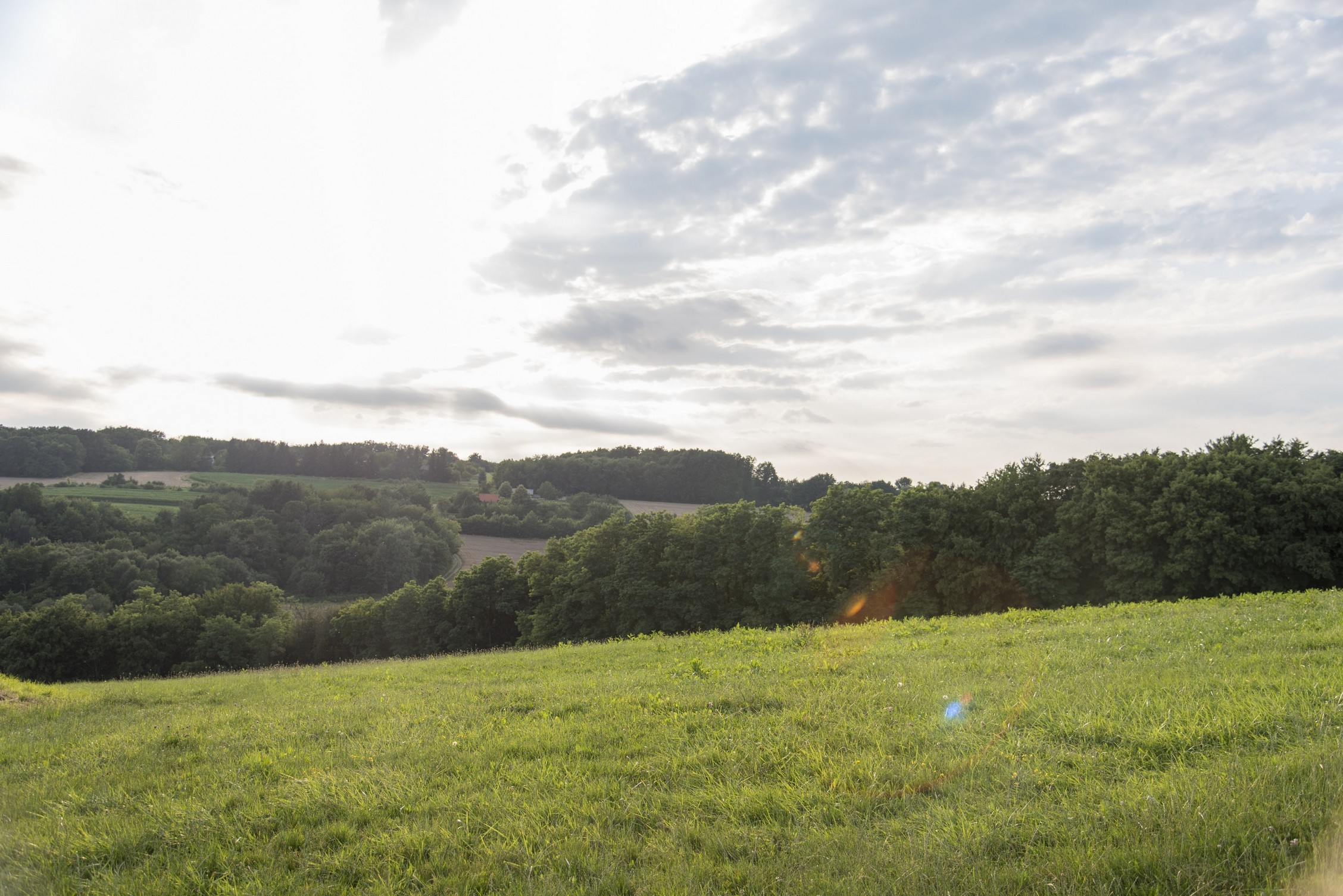
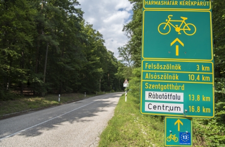
The most important settlements on the Tornyiszentmiklós–Szenthotthárd route are the following: Lovászi, Rédics, Resznek, Nemesnép, Márokföld, Szentgyörgyvölgy, Velemér, Magyarszombatfa, Bajánsenye, Őriszentpéter, Szalafő, Felsőszölnök and the terminal is Szentgotthárd.
Distances in km
|
Tornyiszentmiklós |
(46.5450, 16.5567) |
0 |
|
Lovászi |
|
4 |
|
Kerkateskánd |
|
8 |
|
Lenti |
(Lentiba) |
16 |
|
Rédics |
(Redič, 46.6142, 16.4875) |
22 |
|
Gáborjánháza |
|
27 |
|
Szíjártóháza |
|
29 |
|
Zalaszombatfa |
|
31 |
|
Belsősárd |
|
35 |
|
Resznek |
(46.6669, 16.4742) |
37 |
|
Lendvajakabfa |
|
41 |
|
Nemesnép |
(46.6997, 16.4542) |
45 |
|
Márokföld |
(46.7158, 16.4439) |
47 |
|
Szentgyörgyvölgy |
(46.7244, 16.4075) |
51 |
|
Velemér |
(Velemer, 46.7377, 16.2778) |
56 |
|
Magyarszombatfa |
(Sombatska Ves, 46.7617, 16.3378) |
59 |
|
Bajánsenye |
(46.8017, 16.3842) |
65 |
|
Őriszentpéter |
(46.8389, 16.4211) |
71 |
|
Szalafő |
(Sola, 46.8703, 16.3556) |
80 |
|
Szentgotthárd-Farkasfa |
|
86 |
|
Orfalu (Andovci) |
|
93 |
|
Apátistvánfalva (Števanovci) |
|
96 |
|
Kétvölgy |
(Verica-Ritkarovci) |
100 |
|
Felsőszölnök |
(Gornji Senik, 46.8706, 16.1597) |
106 |
|
Alsószölnök |
(Dolnji Senik) |
113 |
|
Szakonyfalu |
(Sakalovci) |
118 |
|
Szentgotthárd |
(Monošter, 46.9531, 16.2736) |
125 |
Attractions along the route
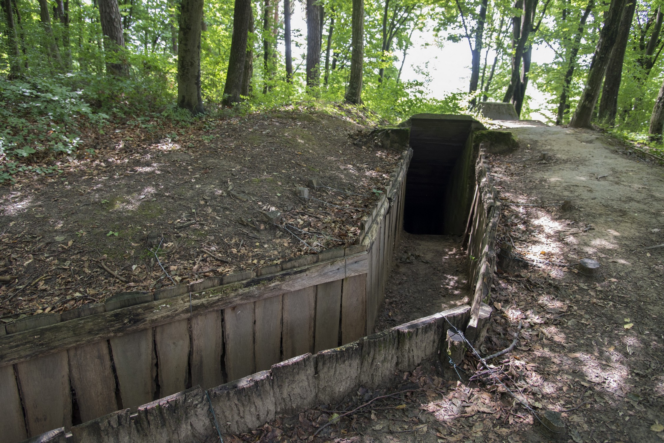
Rédics (Redič)
- Concrete bunkers
- Folklore museum (46.6114, 16.4949)
- Tenke Hill (46.5839, 16.4961)
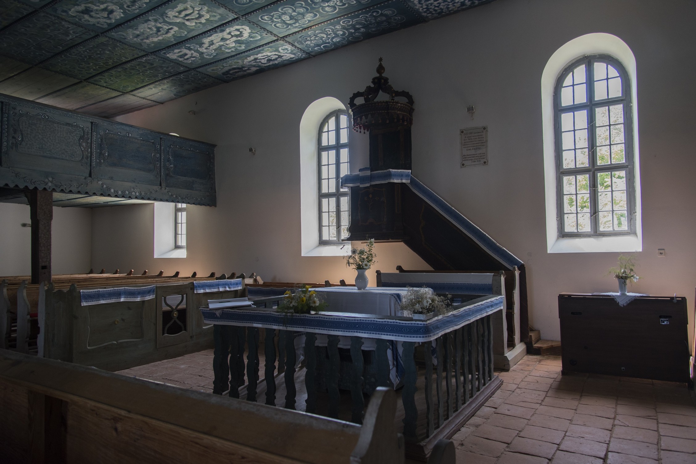
Nemesnép
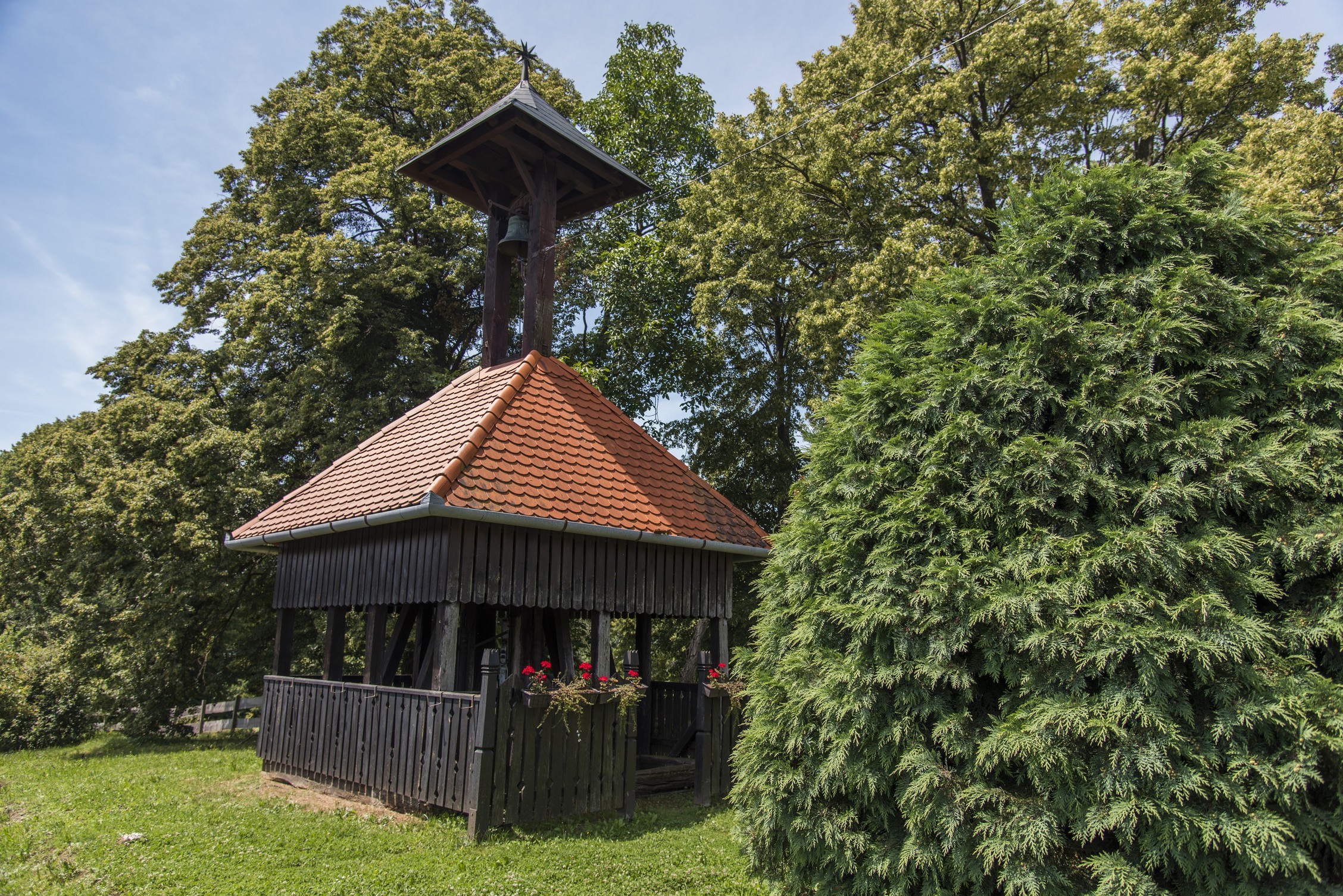
- Calvinist wooden belfry
- Catholic chapel
- Beam bridges
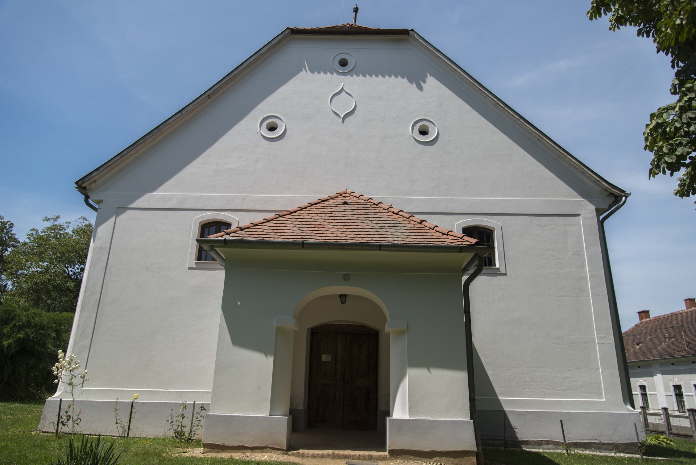
Szentgyörgyvölgy
- Pottery Csótár István’s Workshop
- Catholic church
- Calvinist Chruch
- Forest cultivated by selection (46.7511, 16.4109)
Magyarszombatfa (Sombatska Ves)
- Pottery exhibition
- Memorial Room of Potter János Cugh
- Collection of Hunter Mátyás Gömbös
- Belfry (46.7506, 16.3533)
- Educational trail crossing (Hemerocallis lilio-asphodelus)
Felsőszölnök (Gornji Senik)
- Hungarian–Austrian–Slovenian tripoint (46.8691, 16.1134)
- Water mill and the neighbouring oil-press (46.8859, 16.1848)
- Slovene Pilot Farm (46.8835, 16.1866)
Attractions near the route (tips)
Lovászi
- Bunnkers
Lenti
- Lenti Thermal Spa and St.Georg Energy Park
Márokföld
- Adventure oark
- Levander gaeden
Velemér
- The church of lights
Pityerszer
- Folk building heritage of Őrség
Szentgotthárd (Monošter)
- Pável Ágoston Museum of Local History and the Slovenian Minority
- Cistercian Monastery
- Church of Virgin Mary
- St. Gotthard Spa & Wellness Thermal Bath
- Lake Hársas (46.9394, 16.3139)
Accommodation options
Photo gallery